 |
| Snowdon Massif |
The Paddy Buckley recce was as expected, a blast! Kind of disappointed I didn't get to do the whole thing but the remaining section is very do able alone if I decide to find the time. The two very long and tough days were pretty much just route finding and putting in the miles and vert.
I arrived in North Wales on Friday night at about 8 pm. Darkness was just beginning to fall and I was still able to see where I was. I drove through Betws-y-Coed, the start of the previous race I had done up here, and was at least a bit familiar with the area. A short drive on and everything opened up into more mountainous terrain. I could see Snowdon, the highest point in Wales, and soon was following steep switchbacks up towards it. I felt like I was in Colorado passing through tiny old towns and following narrow winding roads. I finally topped out at a pass with a few buildings and limited parking, I began descending then I soon realized that was Pen-y-Pass and the hostel I was staying at! After a half mile of no where to turn around I was able to and headed back up.
 |
| driving into the mountains |
I attempted to check in and see if anyone was here yet. I would only recognize one of the four other guys and had never met the others outside of e-mail conversations. I rattled off their names to the guy working the front desk until we found who booked the room, Nathanael Booker. It looked like no one was here yet and I couldn't check in without Nathanael. Not that I drink much but at least there was a bar.
 |
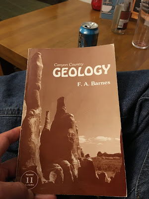
| ironic finding this in North Wales! I spent a great deal of time in Canyon Country! |
After waiting a hour and half a couple guys showed up, fortunately Nathanael, and also my friend Neil. I worked with Neil at the outdoor shop in Birmingham. He was a good guy and the only person there that actually climbed and skied. When I did my first 50 miler at the North Downs Way 50 he was living nearby and stopped by to cheer me on, pretty cool of him. He's an actuary for an insurance company in Zurich now. He hates it despite living in the Alps. He said it's very easy, very boring, and pays a lot, but extremely unfulfilling. So, he's planning on quitting and is training to be a helicopter pilot with dreams of working in the mountains.
After a few short hellos we were booked in and getting ready for bed, everyone having had long days. We had a private room with two bunk beds. We'd use a communal toilet, showers, and planned on eating in the communal kitchen which comprised of four separate fully stocked "kitchens" (sink, fridge, freezer, dishes, etc. stove, oven, microwave) and an eating area through another door. The facilities were basic but in very nice condition. Many of these hostels families use instead of hotels and they're far cheaper.
We stuffed a shoe in the door so one of the guys arriving late could get in. The fifth decide to drive up in the morning.
We slept well and woke at 7am or so. No hurry really. We got what little gear we were bringing; basic ultrarunning kit I'd raced with, food, and water, and went to the kitchen to have breakfast. Plans changed a bit due to snow up high which was going to possibly melt off during the day. We decided to do the lower elevation section first. Capel Curig to Aberglaslyn.
 |
| first few tops |
 |
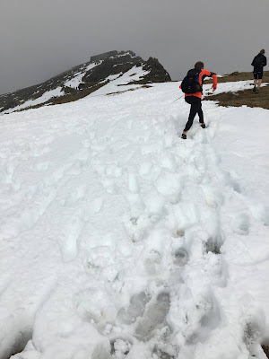
| post hole fun |
 |
| Dan hauling himself out of the bog |
It was slow going through the grassy inconsistent footing relentlessly climbing up and tagging "bumps" of hills that were GPS way marked as the official route. The terrain wasn't too steep, you were just always going up or down. Being off trail the downs weren't as fast as one would expect. Long, some of them, but hopping hidden rocks and bunches of grasses isn't quick work, and add in the occasional snow field of breakable crust.
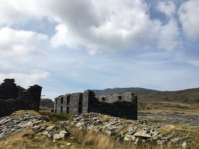
The view appeared to be just rolling hills but soon they exposed huge drop offs into slate quarries abandoned over 100 years ago with distant views of the sea. I recognized sections of the Snowdonia 50 I had run previous. The quarries were open pit mines carved in to the hills that also had a plethora of underground tunnel systems bored deep into the earth, many of which are open to exploration. The remnants of building foundations were everywhere, built with carefully laid and stacked stone. The bluish black slate being so durable appeared recently built with construction abandoned, but the demeanor of the Welsh weather gave it a feel something very old and out of Game of Thrones. I love it up here.
 |
| Quarry down below, the far high points we dropped out packs at |
 |
| old quarry buildings, this is in the above photo at the pass |
 |
| fun trail to the out and back |
We crossed back over the pass and up to the final two tops on the map. A little technical scrambling and we were on the final descent to the car at Aberglaslyn. It went on forever but was fast and not so technical you had to slow your pace, fun running to finish off a wet boggy day. Soon we were on an old farm track littered with rocks, ruts, and puddles. Choosing the fastest line reminded me of mountain biking in Moab, planning ahead to make it down without tripping or keeping a smooth flow. Off the track and onto pavement. A narrow lane with sparse houses led to a busier road and shortly we were at the Aberglaslyn parking lot. Around 23 miles and 8,000 feet of climbing.
We were all pretty spent and ready to be done. A short drive, a little shuffling of cars to accommodate parking and soon we were showered and eating chili that one if the guys brought with in the communal dining area. No beers, no celebrations, just shower, eat, sleep. We had another bigger day tomorrow.
After a quick breakfast we were pretty much ready to go. Not too much to carry in all reality so prep time was minimal which is nice. It's great to be with people who are organized and ready to roll with the task at hand. Climbers are like that, which most of these guys were. They'll skip the party in order to focus on the goal, early to bed early to rise when needed, time is of great value to the overall experience.
One guy opted out of the second day's run so he dropped us off where we finished the day before at Aberglaslyn and would be picking us up in Llanberis at the end of the route. He had a beautiful day to sit around and read or do nothing, the morning was misty and cold but blue skies were expected, I was partially jealous. Sometimes when I'm driving to an ultra I think to myself, "I should be driving to Cornwall with a surfboard, not to run for 20 hours!"
We headed up of course through moss covered hardwood forest. Creeks flowed seemingly in every direction as we meandered back and forth on and off the path through the trees to find the easiest route. We popped out of the forest and into moorland. It was nice to have warm dry feet for the first 20 minutes, so much for that, the cold of the bog water seeped into my shoes soaking my socks yet again. The grassland was hilly and strewn with stone fences going in all directions. Remnants of sheep herder stone huts overlooked the valleys below.
 |
| old hut remains |
 |
| a lot steeper than it looks, cold too! |
 |
| really fun descent in the background |
 |
| Nantlle Ridge looking towards Snowdon |
 |
| Snowdon Massif |
We crossed through some farmland and followed an old stone fence, you guessed it, up. Grassy slopes with the occasional rocky break we continued to the next couple waypoints. The good weather stuck but Snowdon was becoming covered in clouds.
 |
| heading up to Tregalan and Snowdon |
 |
| heading up towards Snowdon |
On our way down we saw a coast guard helicopter practicing touchdowns on a grassy knoll. Pretty cool. The North Wales mountains can be a very nasty any time of the year and mountain rescue is called out fairly often it sounds. The final few miles were nothing spectacular other than the finally of a another fantastic big day out. One long grassy descent into farms, neighborhoods, and finally the main street in Llanberis. We sat along the road enjoying the sun waiting for everyone to catch up and also for our shuttle. Around 23 miles adn 12,000 vertical feet. A doozy.
 |
| Llanberis High Street |
I'll hopefully be back on my own to finish the route and fingers crossed these guys get in touch for the Scottish version, The Ramsay Round, in the future.
The photos really don't do this place justice. It's very difficult to show the expanse of the area. It's odd also as it's still a really small place. Most of the photos you see terrain we either ran early in the day or did later in the day. This is definitely my favorite place in the UK and hope to be back again.Sorry about typos, formatting, and the lack of improving photo quality (you'll notice the couple I did do on Instagram). It takes a huge amount of effort just to type this with kids running around!


